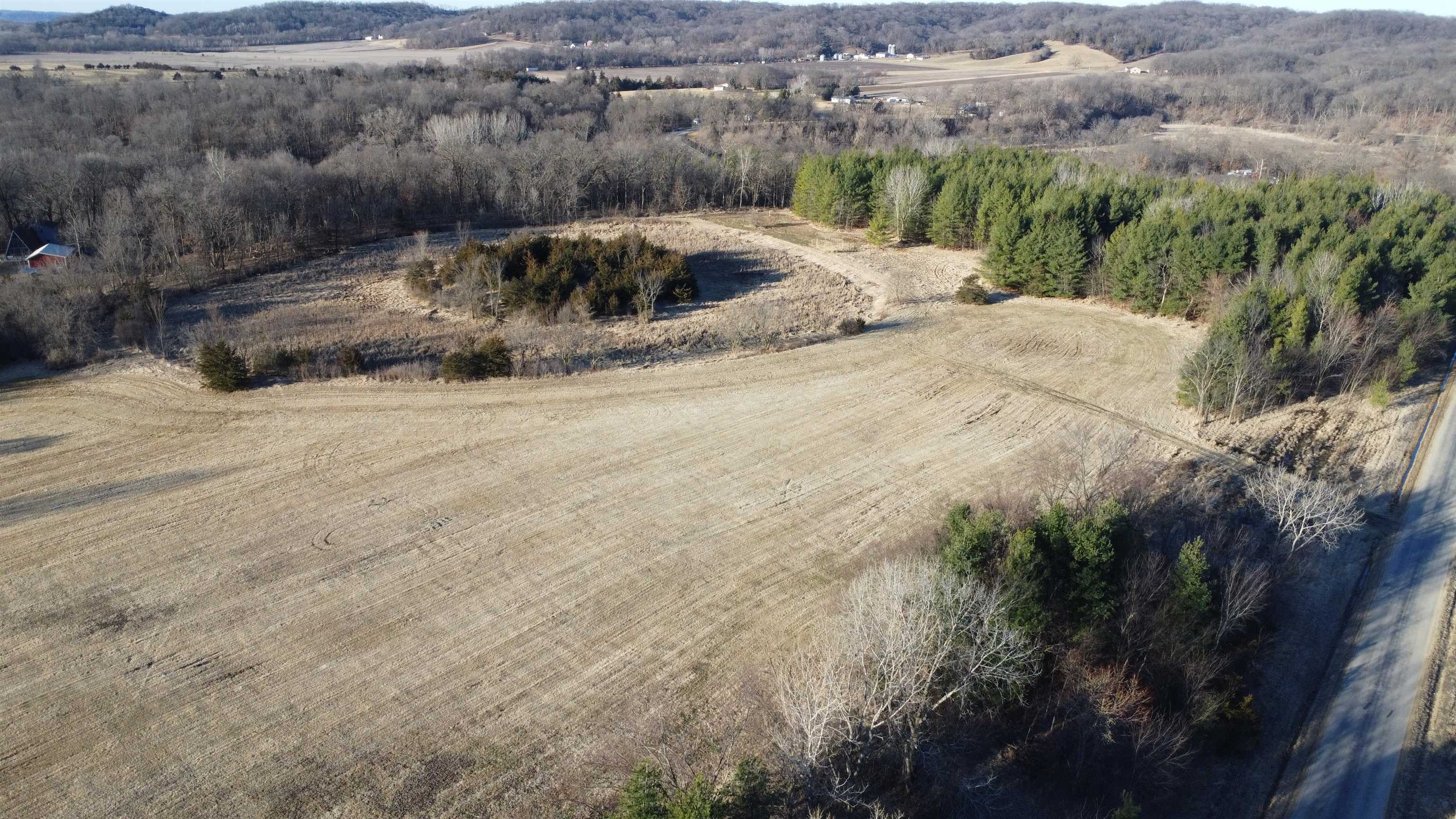
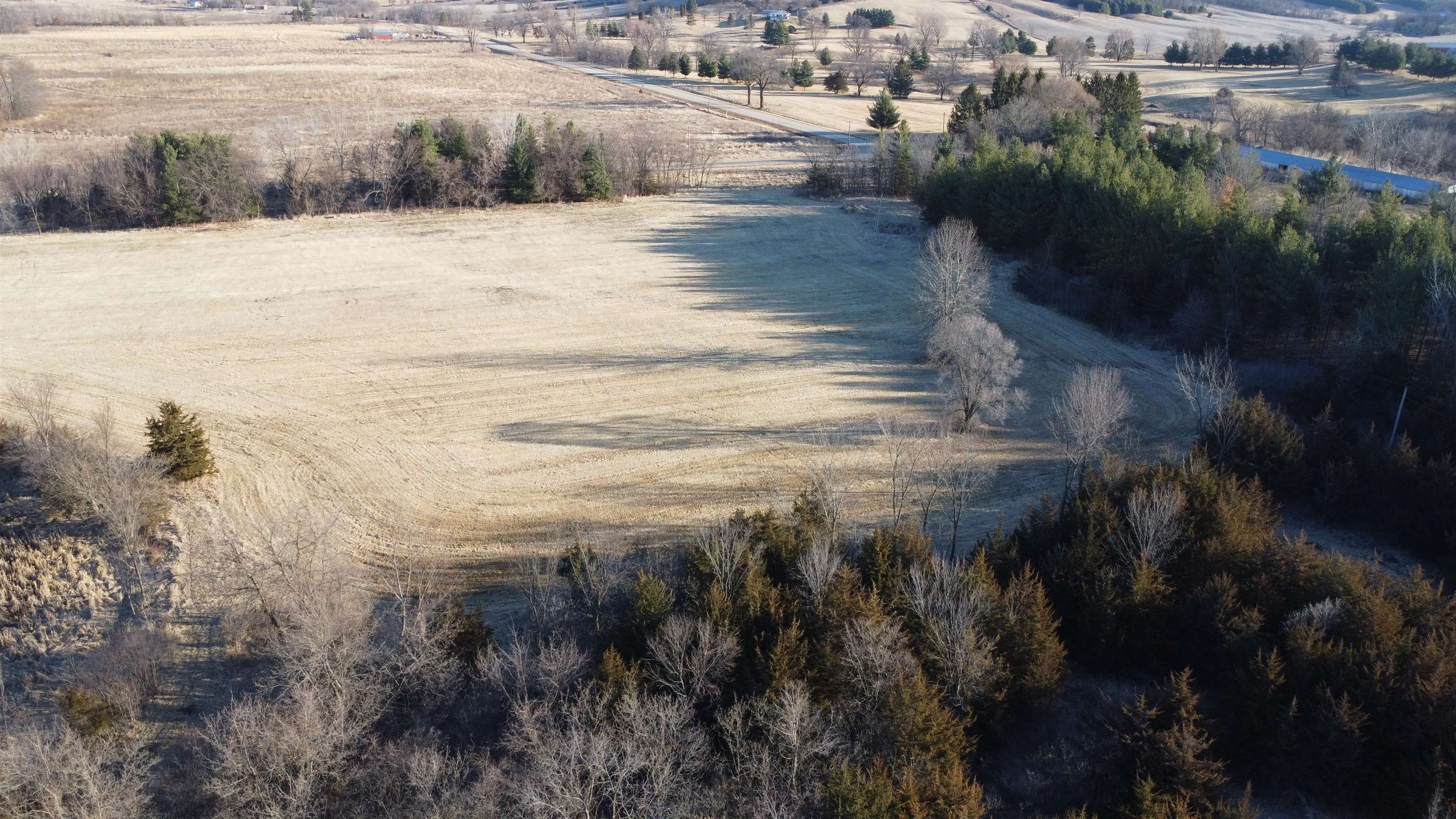
Aerial view of an open rural field bordered by woods, with roads along two sides.
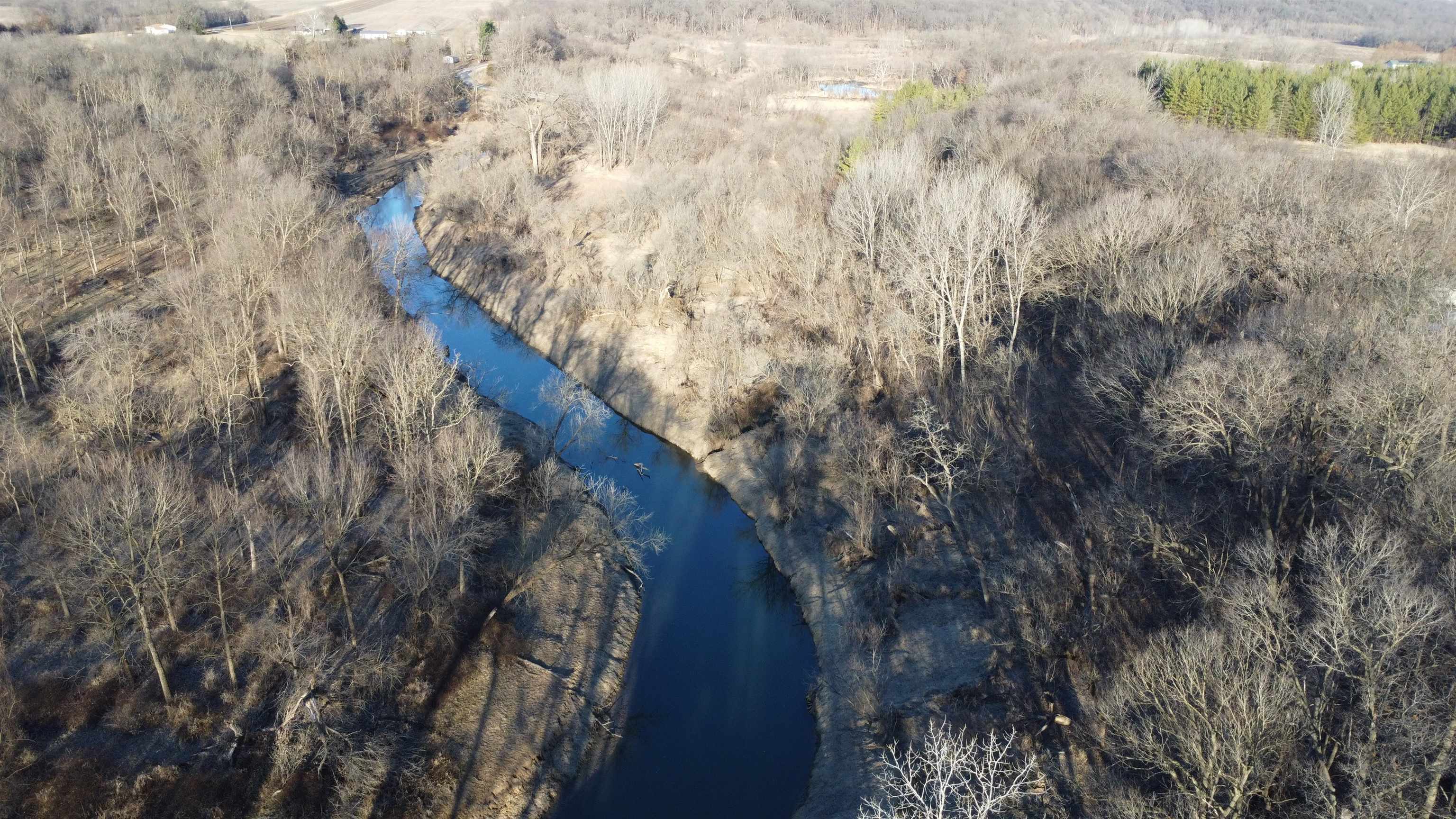
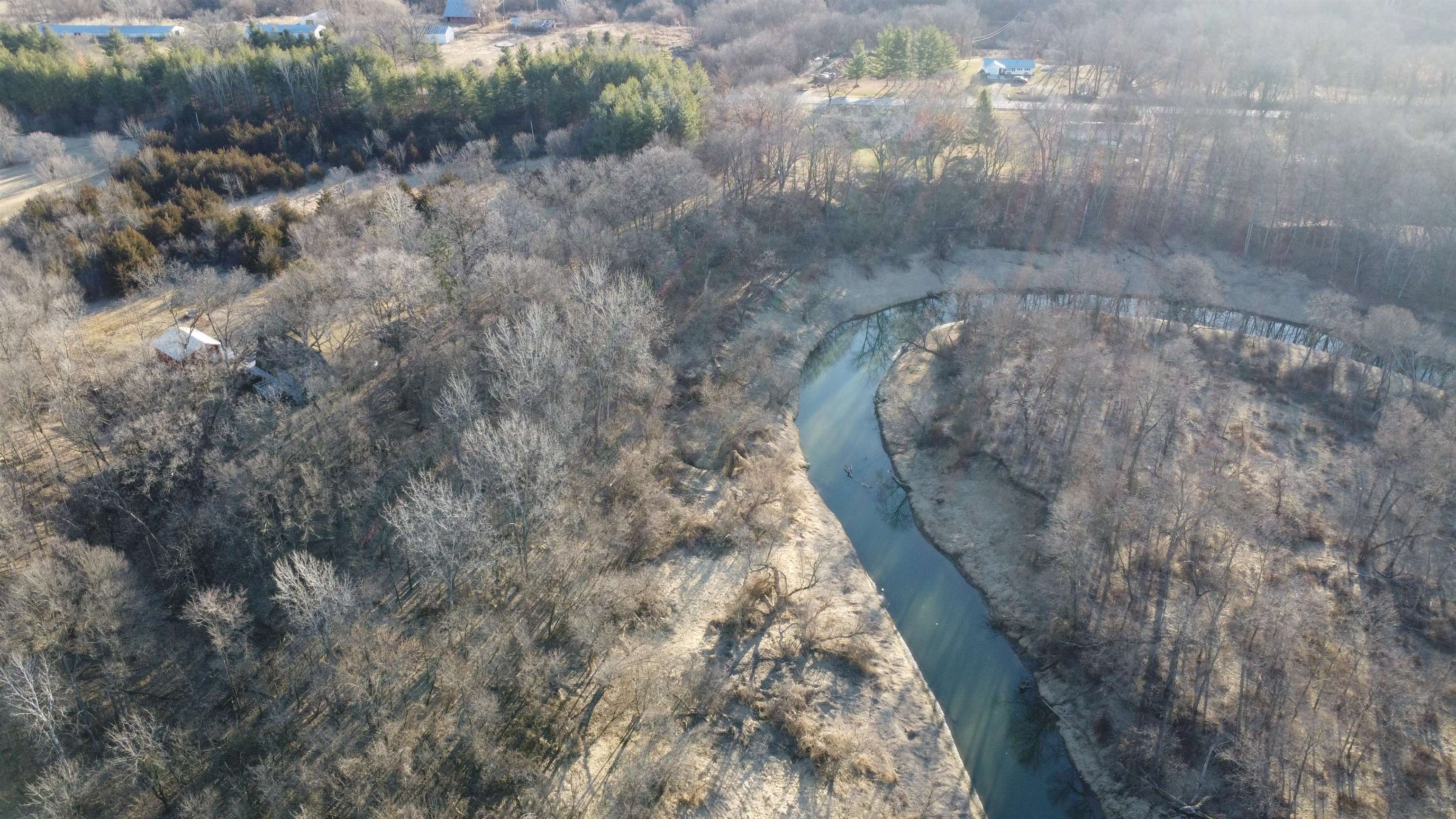
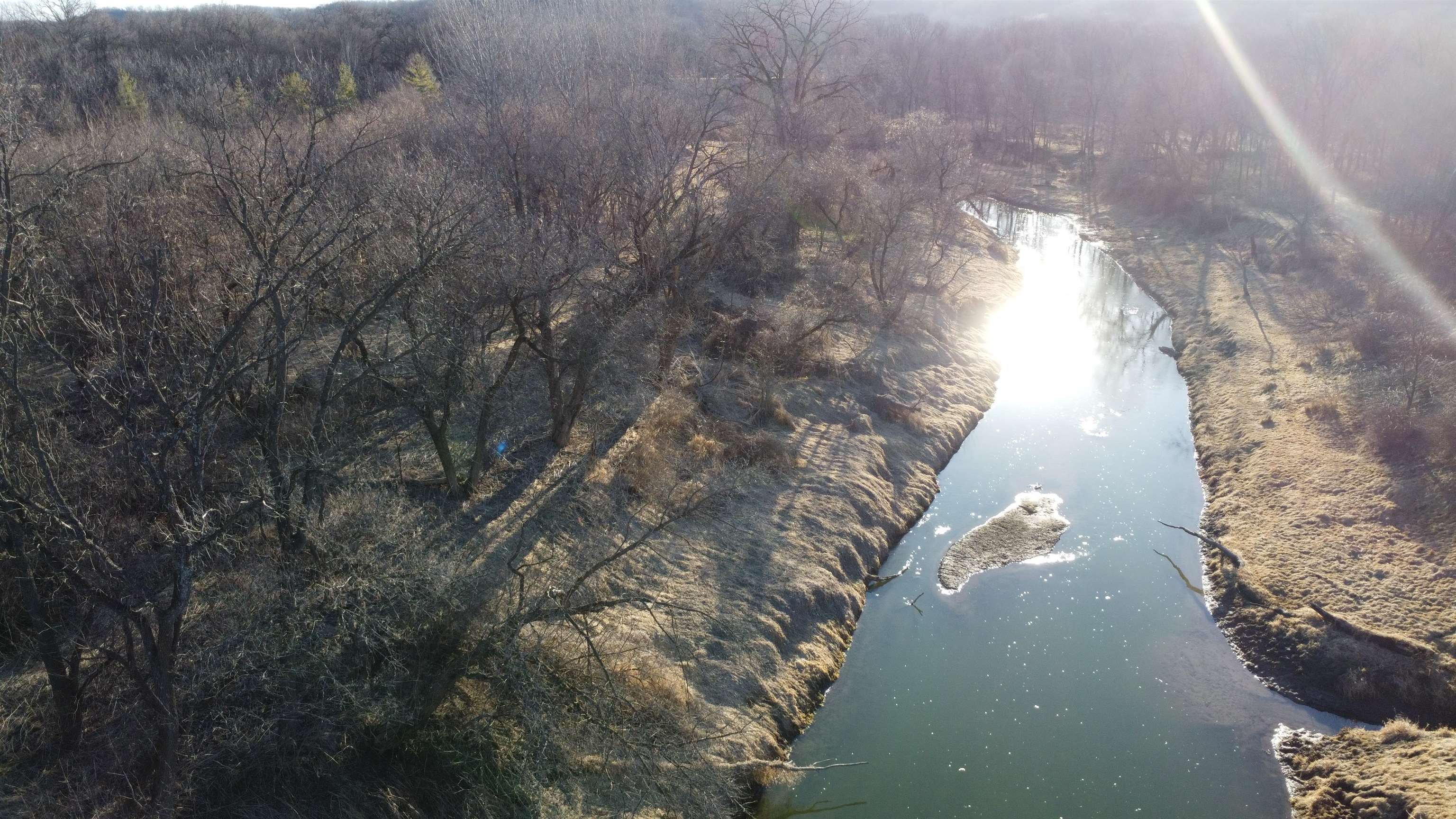
Aerial view of wooded land with a winding creek and leafless trees.
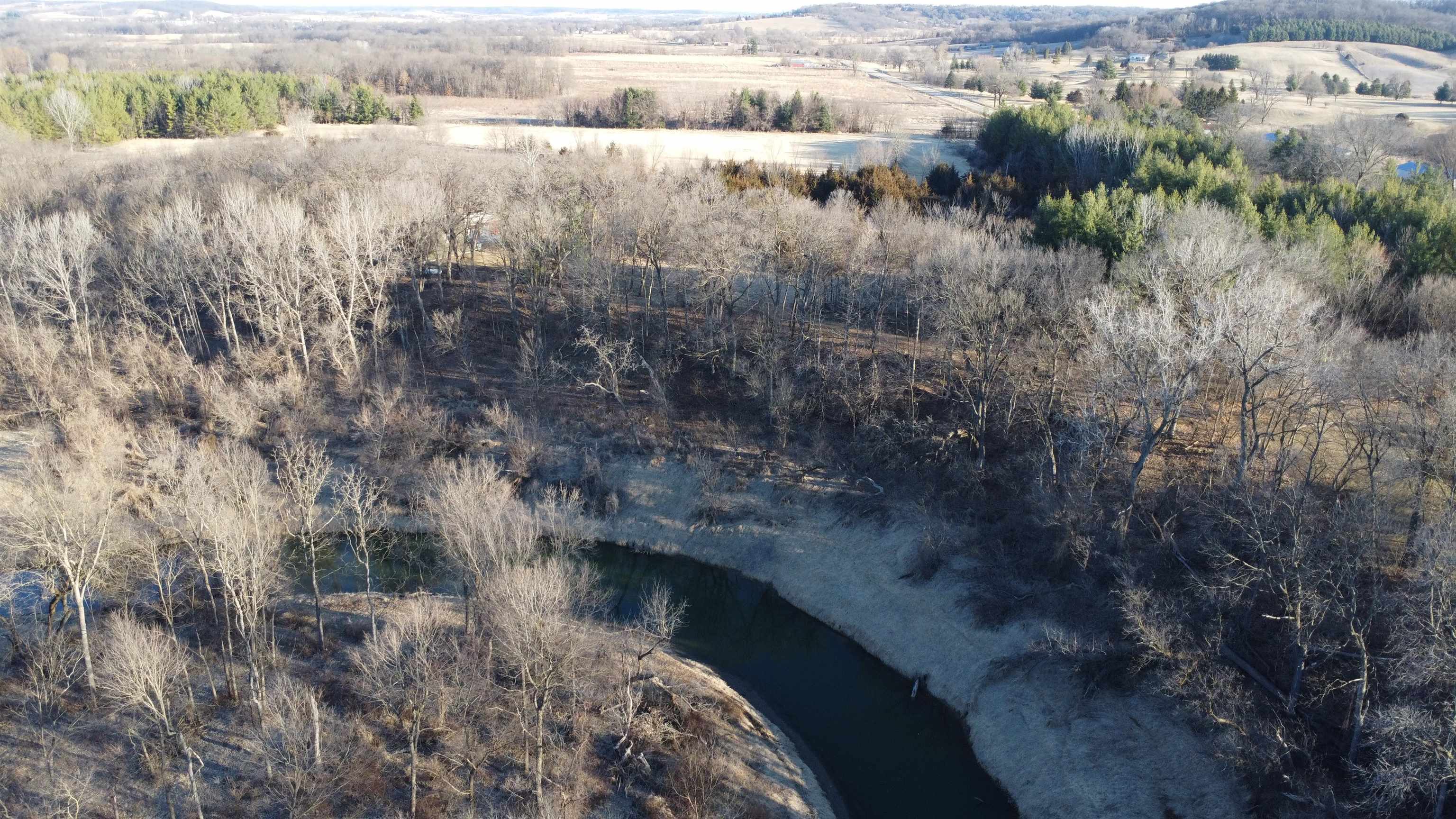
Aerial view of wooded acreage with a winding creek and open fields beyond.
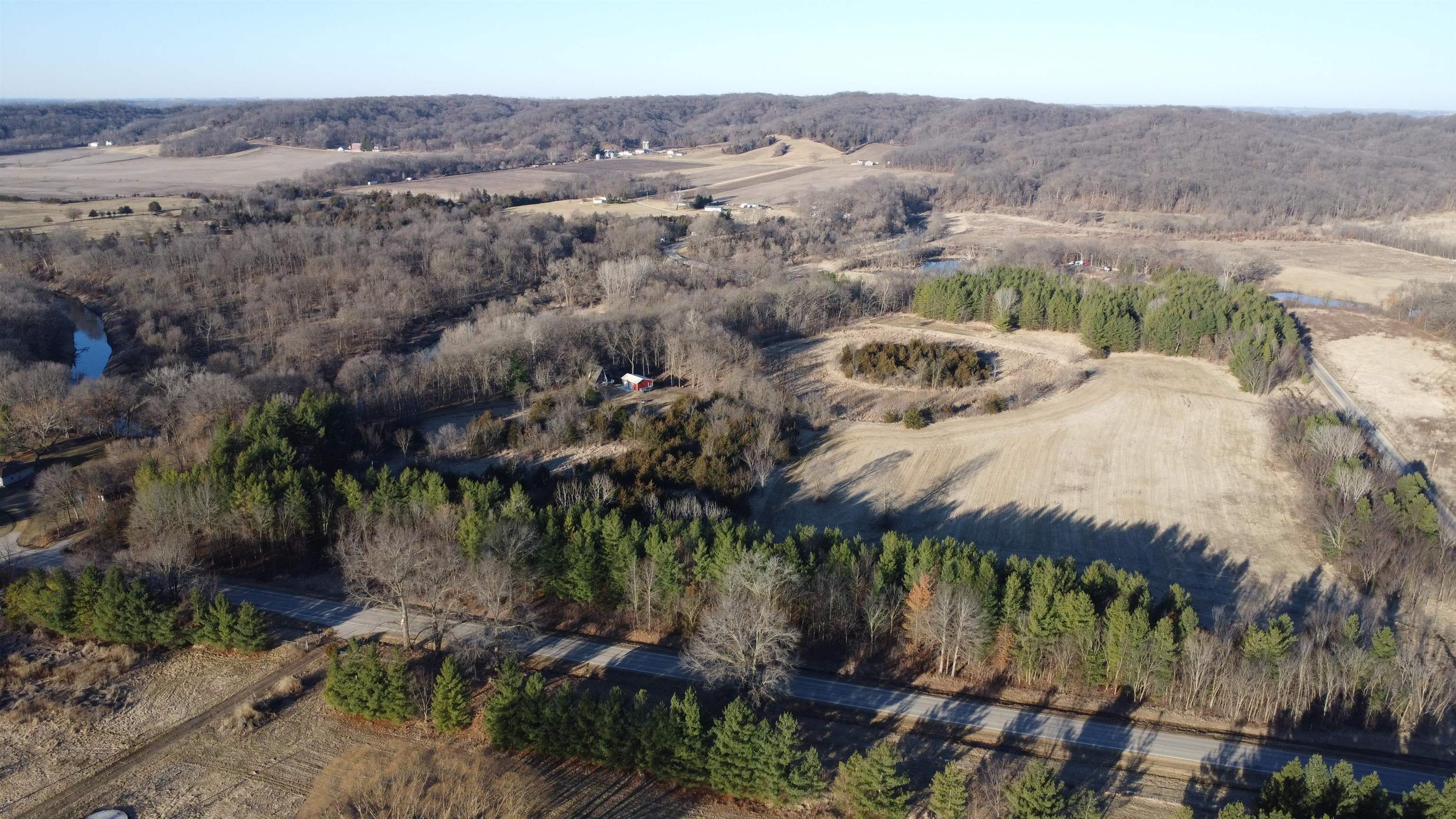
Aerial view of rural acreage with open fields, woods, and ponds beside a road.
Aerial view of open rural fields bordered by woods and roads.
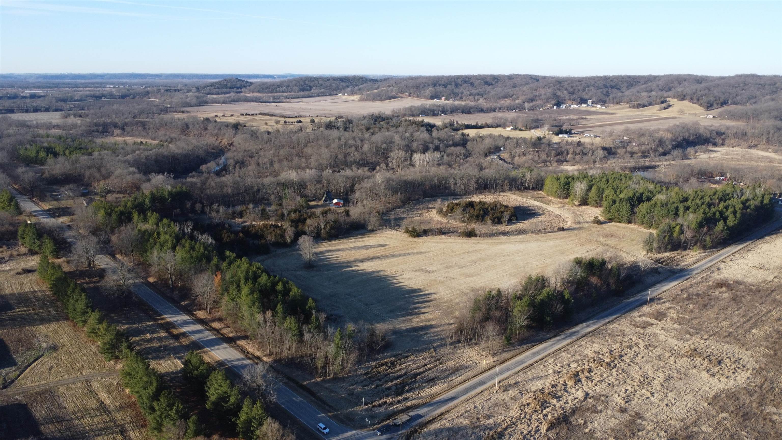
Aerial view of open rural land bordered by woods, with a paved road along the right side.
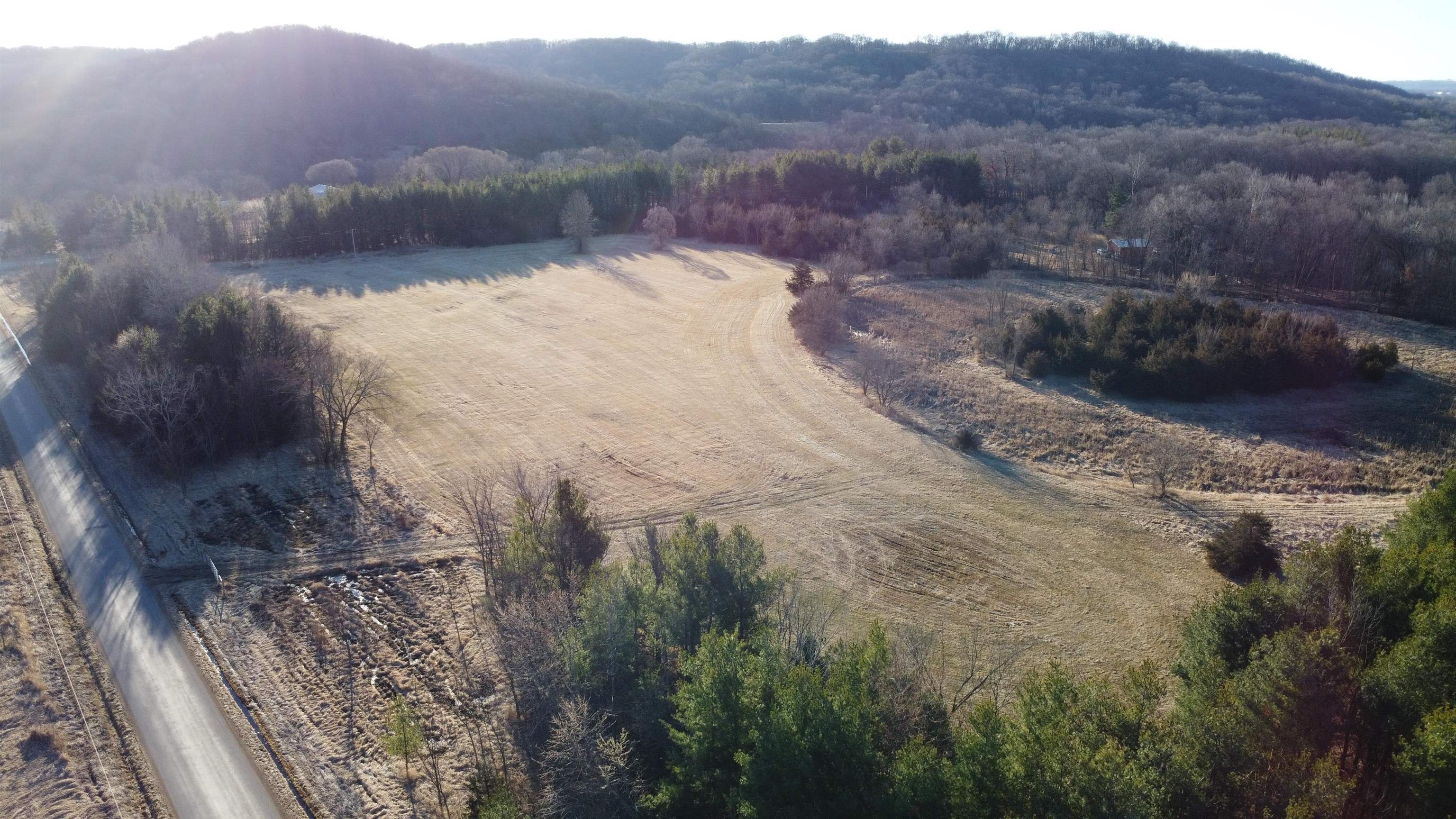
Aerial view of a frost-covered open field bordered by woods, with a rural road along its left edge.
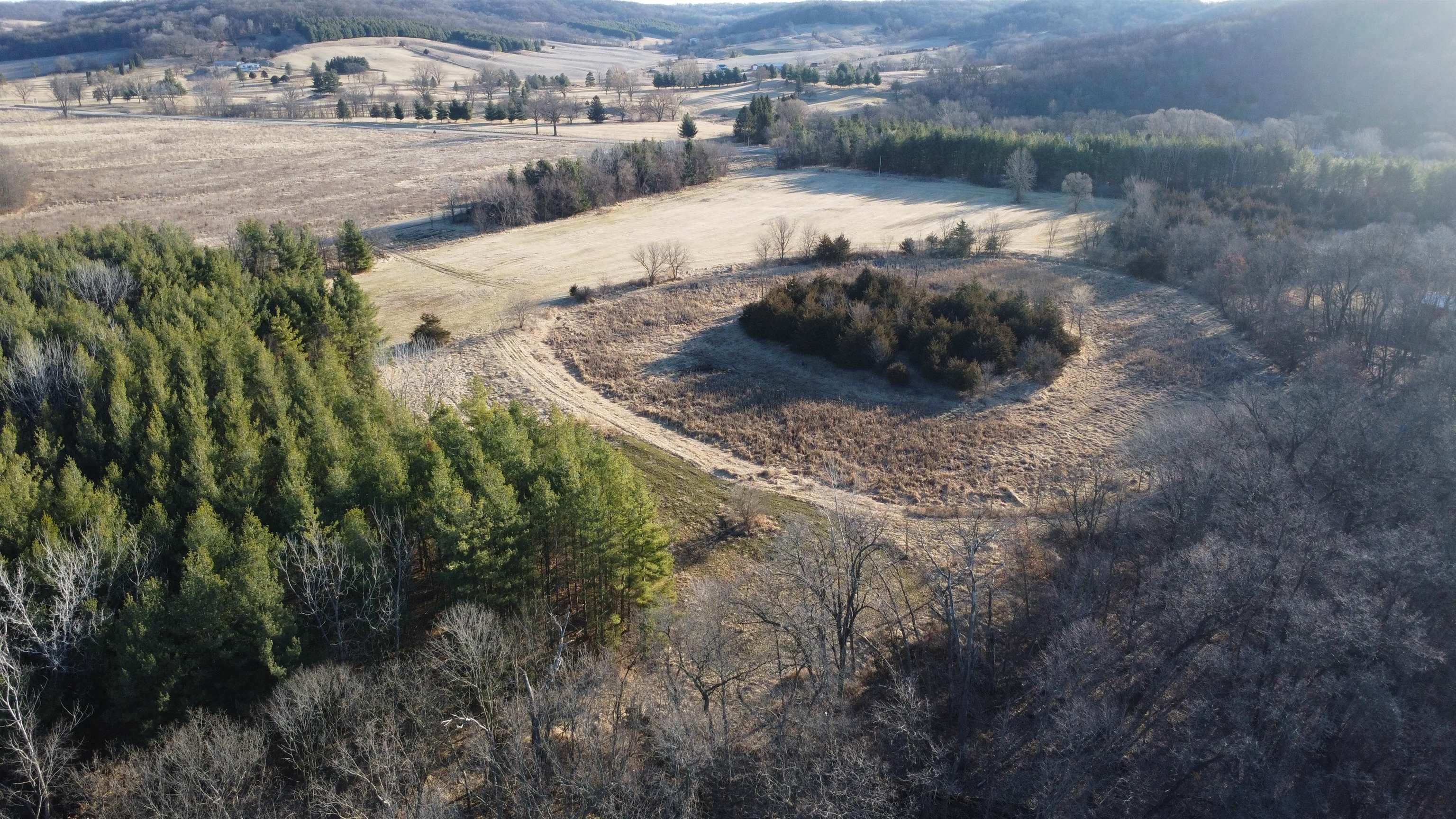
Aerial view of open acreage with a curving track, meadow, and surrounding woods.
Aerial view of wooded acreage along a winding river, with a small outbuilding nearby.
Aerial view of an open field bordered by woods and leafless trees.
Aerial view of a winding creek through leafless woods, with patches of ice along its banks.
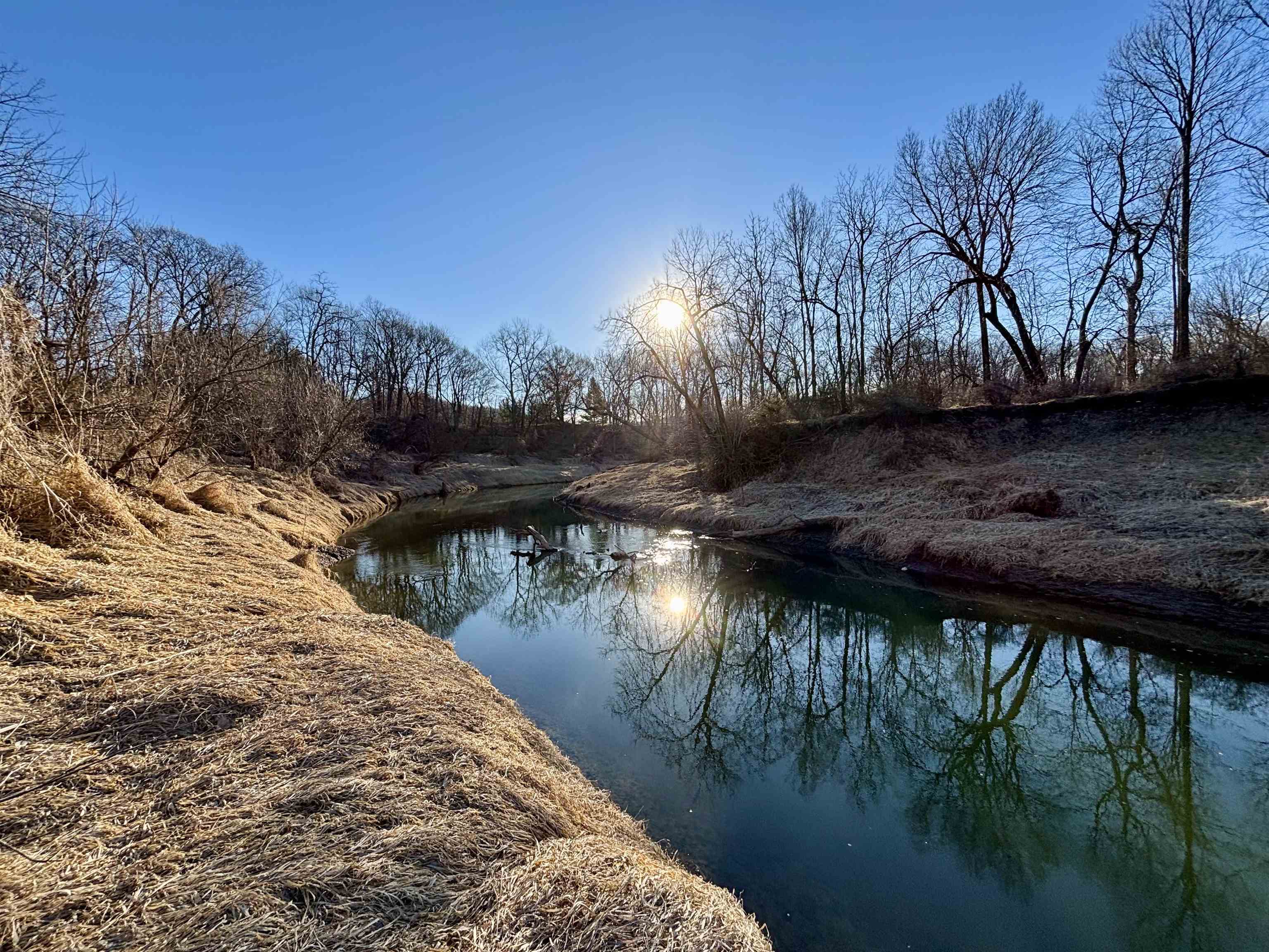
Creek winding between grassy banks and leafless trees, with sunlight reflected on the water.
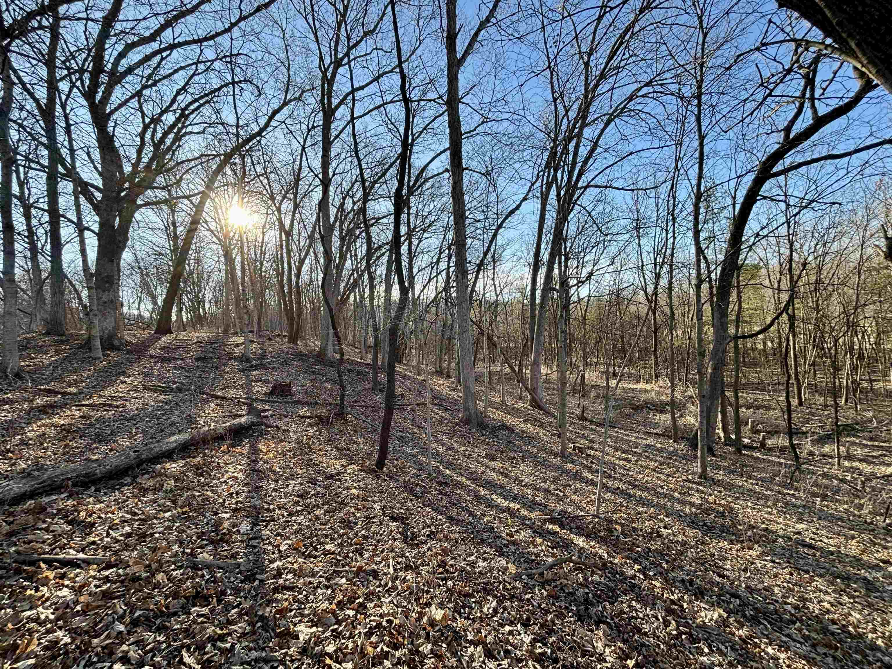
Wooded land with leaf-covered slopes and bare trees in low sunlight.
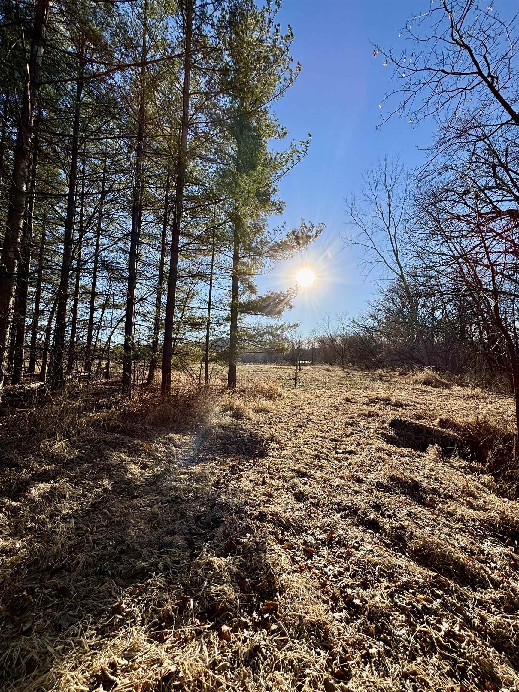
Wooded acreage with a dry grassy clearing bordered by pines and leafless trees.
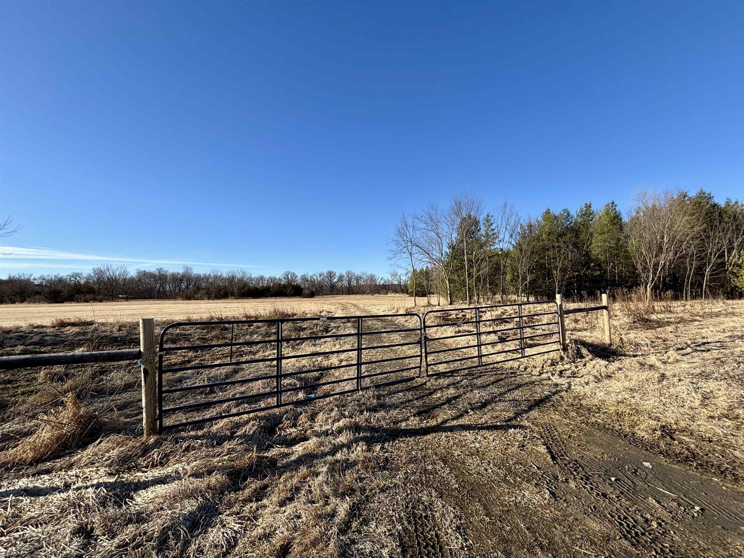
Rural acreage behind a black metal gate, with an open field and woods along the right side.
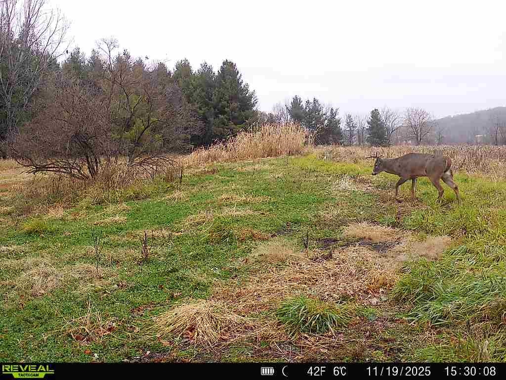
Rural acreage with a deer crossing a grassy clearing bordered by autumn trees.
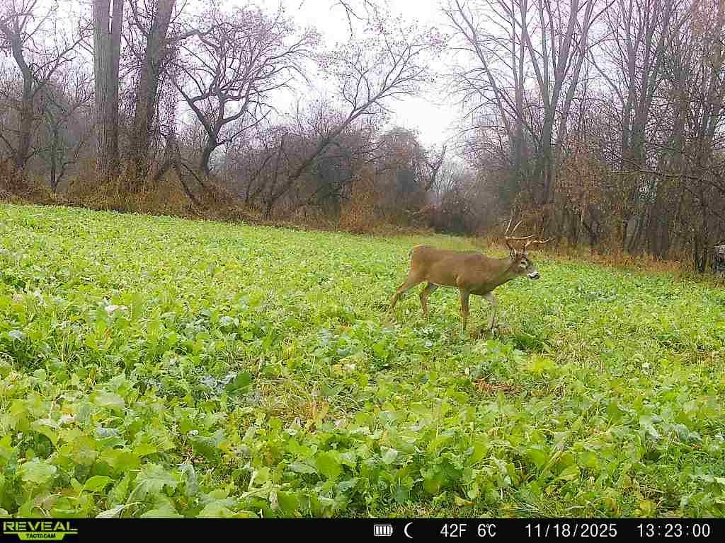
Buck standing in a green field beside a wooded edge.
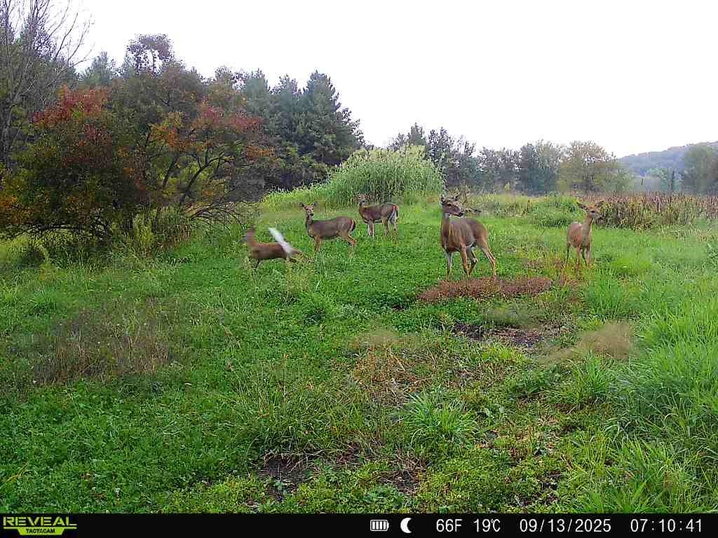
Grassy clearing with five deer near a wooded edge.
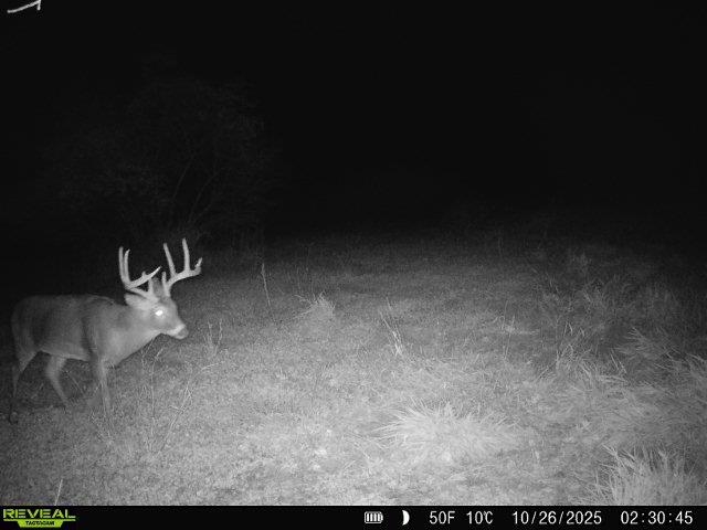
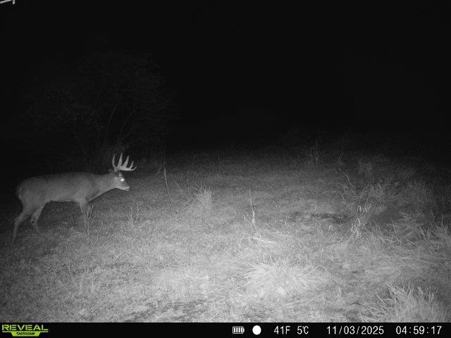
A buck stands in a grassy field at night, captured by an infrared trail camera.
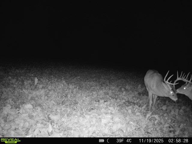
Two antlered deer stand in a harvested field, captured at night by a trail camera.
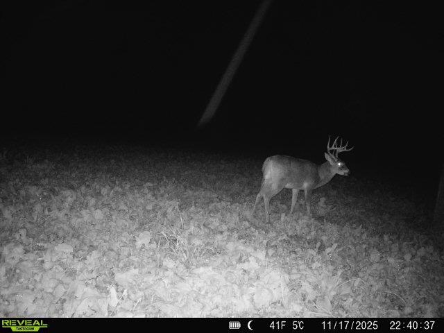
A buck stands on leaf-covered ground in a nighttime trail-camera image.
Buck standing in grass on the property at night, captured by an infrared trail camera.
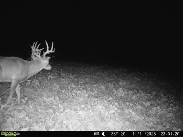
Buck standing on leaf-covered ground at night, captured by a trail camera.
Aerial view of a wooded land parcel outlined in yellow, with open fields, creek frontage, and road access.
Aerial view of a 20-acre parcel outlined in yellow, with fields and woods near Route 84.
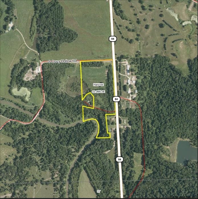
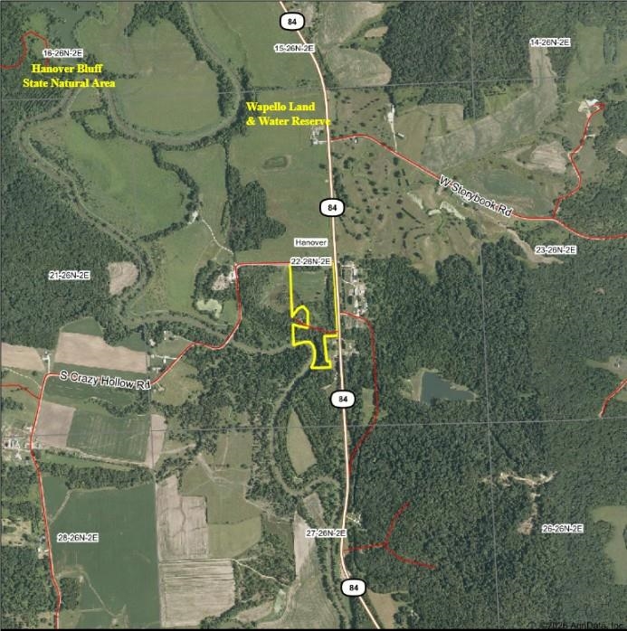
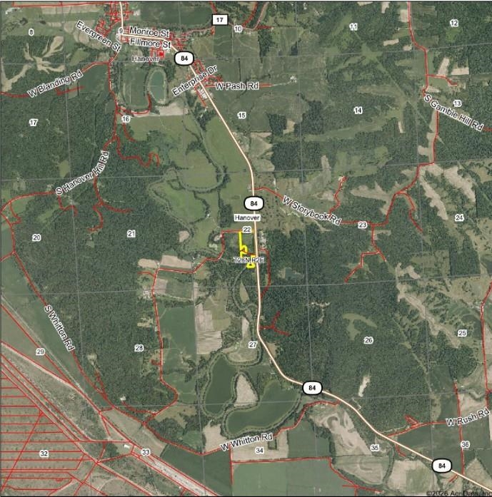
Aerial map showing a yellow-outlined land parcel beside Route 84 near Hanover, Illinois.
Aerial map showing a highlighted parcel near Hanover, Illinois, along Route 84.
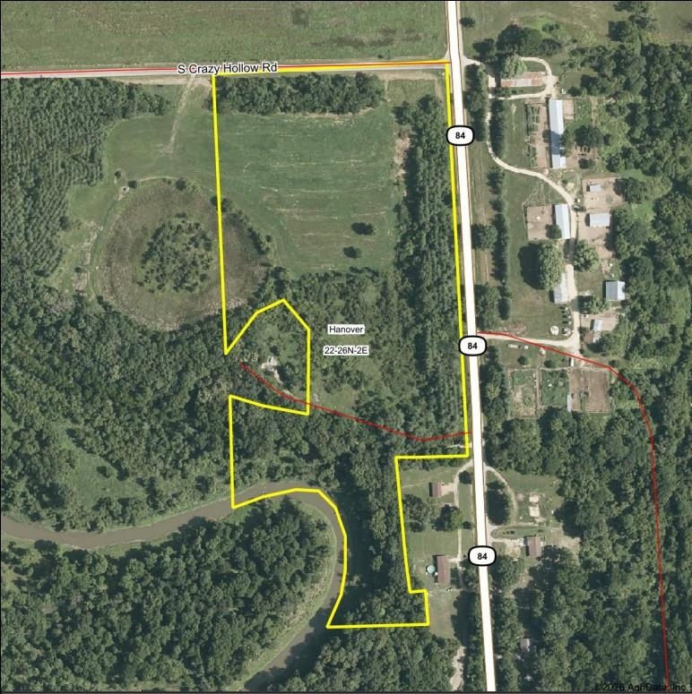
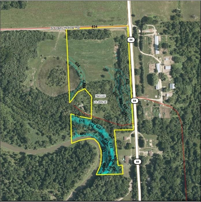
Aerial parcel map of wooded acreage near Hanover, outlined in yellow beside S. Crazy Hollow Road and Route 84.
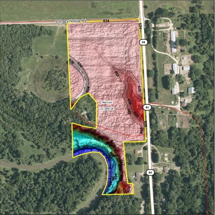
Map of a 20-acre parcel near Hanover, outlined in yellow with colored topographic contours.
SEE ALL PHOTOS
Aerial view of an open rural field bordered by woods, with roads along two sides.
Aerial view of wooded land with a winding creek and leafless trees.
Aerial view of wooded acreage with a winding creek and open fields beyond.
Aerial view of rural acreage with open fields, woods, and ponds beside a road.
Aerial view of open rural fields bordered by woods and roads.
Aerial view of open rural land bordered by woods, with a paved road along the right side.
Aerial view of a frost-covered open field bordered by woods, with a rural road along its left edge.
Aerial view of open acreage with a curving track, meadow, and surrounding woods.
Aerial view of wooded acreage along a winding river, with a small outbuilding nearby.
Aerial view of an open field bordered by woods and leafless trees.
Aerial view of a winding creek through leafless woods, with patches of ice along its banks.
Creek winding between grassy banks and leafless trees, with sunlight reflected on the water.
Wooded land with leaf-covered slopes and bare trees in low sunlight.
Wooded acreage with a dry grassy clearing bordered by pines and leafless trees.
Rural acreage behind a black metal gate, with an open field and woods along the right side.
Rural acreage with a deer crossing a grassy clearing bordered by autumn trees.
Buck standing in a green field beside a wooded edge.
Grassy clearing with five deer near a wooded edge.
A buck stands in a grassy field at night, captured by an infrared trail camera.
Two antlered deer stand in a harvested field, captured at night by a trail camera.
A buck stands on leaf-covered ground in a nighttime trail-camera image.
Buck standing in grass on the property at night, captured by an infrared trail camera.
Buck standing on leaf-covered ground at night, captured by a trail camera.
Aerial view of a wooded land parcel outlined in yellow, with open fields, creek frontage, and road access.
Aerial view of a 20-acre parcel outlined in yellow, with fields and woods near Route 84.
Aerial map showing a yellow-outlined land parcel beside Route 84 near Hanover, Illinois.
Aerial map showing a highlighted parcel near Hanover, Illinois, along Route 84.
Aerial parcel map of wooded acreage near Hanover, outlined in yellow beside S. Crazy Hollow Road and Route 84.
Map of a 20-acre parcel near Hanover, outlined in yellow with colored topographic contours.
For Sale

20 Acres +/- TBD S. Crazy Hollow Road

20 Acres +/- TBD S. Crazy Hollow Road, HANOVER, IL 61041

$195,000
Hard to find 20 acre +/- parcel in scenic Jo Daviess County with approximately 615 feet of frontage on the beautiful Apple River. Located just south of Hanover, this property offer access off Illinois Route 84 and S. Crazy Hollow Road while also maintaining privacy that is provided by tall rows of White Pine planted along the perimeter. The northern portion of the property is an approximately 5 acre field that is currently cut and baled for hay, but offers a blank slate for hobby farming, habitat projects, or potential build site for those willing to pursue the appropriate zoning channels to do so. The southern portion of the property has pines, cedars, and hardwoods before dropping down to the Apple River as it make a bend and turns south. With tall wooded bluffs and preserve land surrounding this property, it is located in one of the most scenic areas in all of Jo Daviess County and just a short drive away from Galena. Schedule a viewing to see firsthand! This property is being split off existing Jo Daviess County parcel 09-000-411-00. Exact acreage and boundaries TBD by survey. Up to 44.78 acres available, inquire for more details. This property would require a special use permit in order to build.

20 Acres lot

Brandon Beyer

Brandon Beyer

Features & Amenities

Area & Lot

  • Status For Sale
  • Lot Area20 Acres
  • MLS® ID202601271
  • TypeLand
  • NeighborhoodJo Daviess County
  • View DescriptionRiver View
  • Elementary SchoolRiver Ridge
  • Middle SchoolRiver Ridge
  • High SchoolRiver Ridge
  • School DistrictRiver Ridge

Exterior

  • water SourceOther
  • lot featuresLevel
  • sewerOther

Financial

  • Sales Price$195,000
Aerial view of wooded land with a winding creek and leafless trees.

Schedule a Showing

We would love to show you our beautiful property. Please select your preferred date and time below. An agent will be in touch shortly to confirm your appointment.

Schedule a Showing

We would love to show you our beautiful property. Please select your preferred date and time below. An agent will be in touch shortly to confirm your appointment.

Thank you for your interest in 20 Acres +/- TBD S. Crazy Hollow Road, HANOVER, IL 61041. We are reviewing your request and will be in touch shortly!

Mortgage Calculator

Estimate your monthly mortgage payment, including the principal and interest, property taxes, and HOA. Adjust the values to generate a more accurate rate.

All estimates are provided for informational purposes only. Actual amounts may vary.
$0,000 Your Payment 20 15 65
$0,000 Your Payment

Jo Daviess County

Explore

Let’s Make Your Next Move Count

Whether you’re buying or selling residential property, farmland, hunting acreage, or recreational land, Sullivan Realty offers the local expertise and personalized guidance to help you move forward.

Follow Us on Instagram